
Swiss Standing Deadwood
Mapping standing deadwood across Switzerland from high-resolution aerial imagery, and identifying the climatic and environmental drivers behind it.
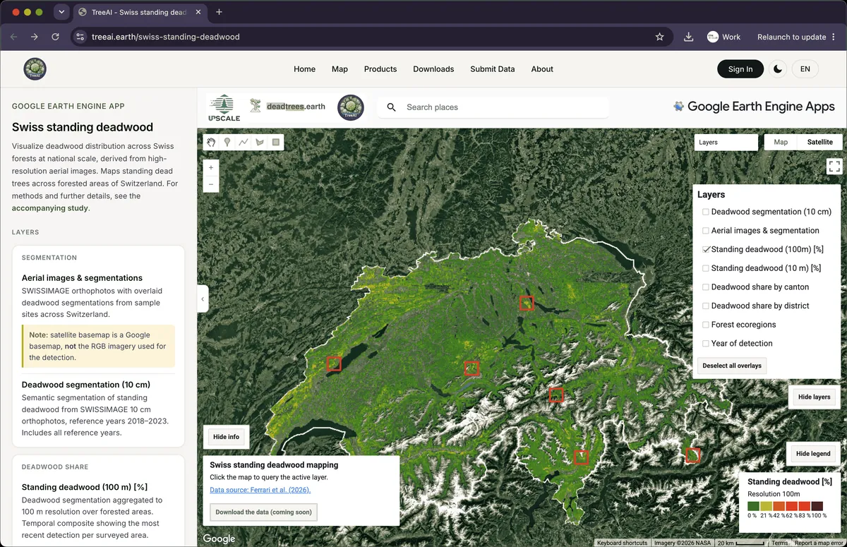
A Switzerland-wide forest mortality assessment: semantic segmentation of high-resolution remote sensing data maps standing deadwood, and random forest models identify the climatic and environmental drivers behind it. Results are explorable in a Google Earth Engine app; a preprint is out and the paper is under review.
The assessment covers 2018 to 2023 and is derived from centimeter-scale aerial imagery (SWISSIMAGE 10 cm orthophotos). It finds standing deadwood concentrated upslope, with the highest shares at mid to high elevations around 1,500 m, and relative increases of up to 43% in overlapping survey areas after the 2018 drought; maximum temperature anomalies and conifer dominance were the strongest predictors. The maps — deadwood segmentation at 10 cm, aggregated shares at 10 m and 100 m, and per-canton and per-district shares — can be explored in the Google Earth Engine app on treeai.earth.
- 18 Jun 2026BuildAnthropic-ETH AI Sprint ↗
- 12 Mar 2026ShipPreprint on EarthArXiv ↗Nationwide deadwood mapping reveals rising mountain forests vulnerability
- LLuca Ferrari